Hi-Target vRTK is an innovative visual GNSS RTK receiver equipped with dual cameras and upgraded IMU tilt compensation, supporting full-constellation (BDS/GPS/GLONASS/Galileo/QZSS/IRNSS/SBAS) tracking, IP68 rugged protection (dustproof, waterproof to 1m, 2m drop resistance) and multi-mode connectivity (4G/WiFi/Bluetooth/UHF); it pairs with the iHand55 professional field controller (Android 11, 5.5" outdoor screen, 9200mAh battery) and Hi-Survey Android software (for land/road surveys, third-party device compatibility) to deliver precise, efficient results for engineering surveying and construction stakeout .
Contact us for the best deal on this product.
Couldn't load pickup availability
Refresh
Satellite Tracking Channels : 1408/1760 channelsSupported Systems & Signals : GPS (L1C/A, L2C, L2P, L5); BDS (B1l, B1C, B2a, B2b, B2l, B3I, supports BDS-3 new frequency points); GLONASS (L1CA, L2CA, L2P, L3); Galileo (E1, E5a, E5b, E5 AltBoc); QZSS (L1C/A, L1S, L2C, L5); NavIC (L5); SBAS* (L1, L2, L5)1.2 Positioning Performance Static/Fast Static : Horizontal 2.5mm+0.1ppm RMS; Vertical 3.5mm+0.4ppm RMSRTK : Horizontal 8mm+1ppm RMS; Vertical 15mm+1ppm RMS (initialization time <10s, reliability >99.99%)PPK : Horizontal 3mm+1ppm RMS; Vertical 5mm+1ppm RMSPPP (B2b) : Horizontal 10cm; Vertical 20cmSBAS : Horizontal 0.5m; Vertical 0.85mTilt Survey : <8mm+0.7mm/° tilt (0~60°), auto-installationImage Positioning : 2~4cm accuracy (2~15m working range); Image Stakeout: 1~2cm accuracy1.3 Physical & Environmental Characteristics Dimensions : 130mm × 79mm (W×H)Weight : <0.97kg (with internal battery)Protection Level : IP68 (1m temporary immersion); MIL-STD-810G (shock/vibration/salt spray)Temperature : Operation -40℃~+75℃; Storage -55℃~+85℃Humidity : 100% non-condensing1.4 Power & Storage Battery : 7.2V/6900mAh Li-ion; RTK rover mode: up to 15 hoursCharging : 5V 2.8A Type-C (supports smartphone chargers/power banks)Storage : Built-in 8GB ROM; supports T-Flash up to 128GB1.5 Communication Cellular : Full-band 4G LTE/WCDMA/EDGE/GPRS/GSMWireless : WiFi (2.4GHz, 802.11 b/g/n); Bluetooth 4.2/2.1+EDR; NFC (touch pairing)UHF Radio : 0.5W/1W/2W adjustable power; 410~470MHz; 3~15km working rangeInterfaces : 1×USB Type-C, 1×SMA Antenna Port, 1×Nano SIM Slot1.6 Data Output Format : NMEA-0183 (ASCII); Output Rate: 1Hz~20HzData Formats : Static (GNS, Rinex); RTK (RTCM3.X)Network Mode : VRS, FKP, MAC; Supports NTRIP Protocol
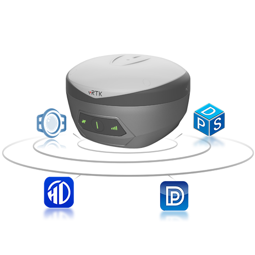
Full-Constellation High-Sensitivity Tracking : New-gen GNSS engine supports BDS-3 B1C/B2a/B2b signals, with multi-frequency anti-jamming and adaptive filtering for stable signals.Upgraded IMU Tilt Survey : Auto-installation, 0~60° tilt compensation, and Hi-Fix function (maintains RTK accuracy for 5min without differential data).Dual-Camera Visual Positioning : 2MP+5MP cameras realize non-contact image survey (2~15m) and live-view stakeout, breaking field operation constraints.AR-Enhanced Stakeout : AR guide lines display in point/line/CAD stakeout programs, achieving 2cm accuracy and improving efficiency.Lightweight & Rugged Design : Pocket-sized (130mm×79mm) and <0.97kg, with IP68 protection and 2m drop resistance for harsh field conditions.Intelligent Power & Connectivity : 15-hour long battery life; one-touch pairing via NFC; full-band 4G ensures stable data transmission.Hi-Fix & PPP Modes : Hi-Fix maintains accuracy without signals; B2b-PPP achieves cm-level positioning without base station/CORS.Multi-Software Compatibility : Works with Hi-Survey software; data compatible with third-party processing/modeling software.
Download Brochure
Download Manual
View full details